Mobility Plus – An Overview
Each part of Auroville’s city plan is linked to the other, either through overlapping, interwoven areas, with interdependent facilities and purpose, shared intentions and of course, by its distinct mobility pattern that holds the city together, most perceptibly at the Crown.
The Crown holds together the zones, the parks, has an important transitional function and therefore calls for a quick mobility overview:
Auroville’s Mobility starts from the centre. It defines its main elements and aims for a quiet, non-polluting traffic model prioritizing pedestrians, cyclists, slow electric vehicles and collective transport. This, in turn, impacts the rest of the city plan. Such basic information has been available from the beginning and certainly through the successive studies we have seen, to allow the experiment to take shape and prevent the city from sprawling through random needs and grow dependent on cars.
As seen in the earlier posts, the Peace Area at the centre holds the Matrimandir, the Banyan, the Amphitheatre and the Park of Unity. The Mother wanted all this to be surrounded by a lake, making the centre an islet, aloof from the rest of the city and accessible only with permission.
Around it would the pedestrian Lake Promenade, making a first round of the city.
Between the Lake Promenade and the Crown lies the City Centre, full of activity, admin, habitat, culture, school and parks, yet an area intended to be very quiet, respectful and in sync with atmosphere of the Peace Area. Its mobility is therefore quiet, largely pedestrian, together with cycles, some non-polluting vehicles and limited service and emergency access. It will have walking paths, cycle paths, special service paths through its green network of parks, corridors and lanes and some service access lanes with specific timings.
The Crown defines the city and its mobility: all that comes in or, goes out or travels around is held together by the Crown. This is not a road to fear but is our inner circulation street, where one gets a sense of what is happening in and around the city, what is flowering in its parks, and from there, step across from the City Centre to the rest of the Residential, International, Cultural or Industrial Zones.
To access the Four Zones one may use electric vehicles or cycles or some non-polluting collective transport system. Here we find the radials that are meant to distribute circulation through the zones. Parking will found along these radials so as not to burden the Crown. In the case of cars, service vans, worker & regular visitors vehicles, these are preferably left in large parking facilities along the Outer Ring. The Outer ring and is not a defined circle, it merges naturally with the green belt with overlapping activities, facilities and infrastructure both ways as needed. The existing tar roads are transit routes for now that carry some transitional traffic through and away.
The Greenbelt allows access into Auroville through roughly 4 points as indicated in most mobility studies, one in each zone. While the Greenbelt will have its own free circulation pathways, for residents, associates and friends, it bears responsibility for maintaining the main access routes into Auroville, with parking facilities at these peripheral access points. This allows the possibility of an early transition to non-polluting circulation with the use of solar/electric trams or other such collective transport system for visitors.
Integrating villages in the greenbelt zone: The existing tar roads remain useful transit systems for now, specially for those heading outward. Those coming into Auroville, or needing to cross the city can join us in the experiment and participate in a new mobility model in India. For this we need to –
- Create non-polluting collective transport in these areas for all those coming in to Auroville.
- Create parking at the Greenbelt periphery or Outer Ring for polluting vehicles and offer transfers to collective transport or electric cycles via radials.
Outbound traffic from Auroville for people going to Pondy or Chennai could similarly transfer to regular taxis at Outer Ring taxi stations or, outbound Auroville collective transport.
The scenario then:
From Matrimandir outward >> the mobility moves in gradients, from silence to a quiet but dynamic city centre, to more the more busy & diverse activities of zones, followed by a quiet exit, through the greenbelt.
From Greenbelt inward << it moves from cacophony and claxon through grades of quiet circulations, easing off the burden of heavy traffic till it reaches the Crown, via the Radials, much lighter now to circulate around this main inner connecting artery, and from there through the City Centre to the silence of the Peace Area.
Key Habit Shifts:
Walkable distances & cycle paths: Within 5 minutes walking distance from the Matrimandir Area (Lake Promenade) lies the Crown. Within another 7 to 10 minutes one can walk from the Crown to the Outer Ring Area.
Slow Speeds. Limit for motorized vehicles 20 kmph to make a noise free, dust free, non-hectic and garbage free streets for a voluntary, conscious town.
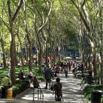
Some essentials to facilitate active pedestrian use in a hot and humid tropical setting
- Shaded architecture with covered walkways, arcades and interconnecting passageways.
- Shaded walkways: tree-lined or canopied otherwise
- Short distances with access to collective or shared transport
The Crown remains the transition point of what is coming in, what is going out and what is going around.
#Auroville City Planning #Mobility #Galaxy Plan #Walkable Cities #Non-polluting traffic